By Hendri Gunawan, Hutan Desa Coordinator
One form of Indonesia’s Social Forestry Initiative is the Hutan Desa (Village Forest). The government grants approval to village institutions to manage and utilize these Hutan Desa, with the aim of improving the welfare of village communities and environmental sustainability.
In July 2021, Yayasan Palung/GPOCP, the community in Lubuk Batu Village and the community of Matan Jaya Village, proposed that the forest area in these villages be managed by the community through the Hutan Desa framework. Lubuk Batu, which is on peat forest, has been proposed with the status of production forest. It makes up an area of about 1,800 hectares. Meanwhile, Matan Jaya, which contains montane forest, is proposed with the status of protected forest, and makes up an area of about 1,900 ha. In order for Hutan Desa to be officially decreed, a series of steps must be carefully carried out. The final step is the technical verification.
However, since the proposals were first submitted in 2021, this process has been constrained by the COVID-19 pandemic. Specifically, local travel restrictions meant that people could not enter and exit Kayong Utara Regency, thus hindering the implementation of technical verification in the field. This step is essential, as in order to become designated by the Ministry of Environment and Forestry of the Republic of Indonesia, technical verification must ensure the proposed Hutan Desa is administratively included in the village area that proposed it, ensure appropriate membership of the Hutan Desa Management Board (LPHD), ensure the area has no land disputes, and more.

From February 10th to 11th, 2023, technical verification was carried out by a team consisting of the Kalimantan Region Social Forestry and Environmental Partnership Agency (BPSKL), the West Kalimantan Province Environment and Forestry Service (DLHK), the Forest Area Consolidation Center (BPHK) Region III Pontianak, the Forest Management Technical Implementation Unit (UPT KPH) of Kayong Region, and Yayasan Palung/GPOCP as Working Groups and independent assistants for the Hutan Desa program.
The aim of this activity is to find out directly and synchronize field conditions regarding the ‘subject’ of the applicant, and also the ‘object’ of the forest area that is proposed to become a Hutan Desa. The results of the technical verification then become the basis for issuing the Hutan Desa Management Agreement (PPHD).
During the ‘object’ verification process, the team conducted a field survey of the proposed forest areas in Lubuk Batu and Matan Jaya villages in order to see the areas proposed as Hutan Desa first-hand. The field survey activities included recording the land cover of the proposed area, collecting data on the elevation, vegetation and animals, and taking coordinate points for the outer boundaries of the area. We also collected data on potential non-timber forest product (NTFP) resources, noting location points that have already been worked on by the community. We also took coordinates of other important points such as the village office, area boundaries, area function boundaries, forestry licensing boundaries, and natural tie points like rivers and roads.

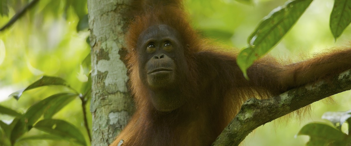
The results of the field survey in Lubuk Batu village showed that there is potential for the use of NTFPs in the form of honey, rattan and medicinal plants, and the potential for utilization of environmental services in the form of carbon. In addition, we saw several orangutan nests, heard the sounds of gibbon calls, and saw the scratch marks of sun bears on tree trunks, which indicates that this forest is home to a variety of protected animals. The area does not have arable land that is currently used by the Lubuk Batu community, but there are several areas utilized by other village communities, especially along the banks of the river. Later, once approved as a production forest, the community will grow coffee plants.
In Matan Jaya, the verification field survey found potential for NTFPs such as rattan and medicinal plants, and the potential for clean mountain water that can be managed directly by the community. In addition, this hilly region covered with beautiful rocks is habitat for hornbills and gibbons. However, we found several points of construction of community housing within the proposed protected forest area. There is also a road that divides the area and an independent plantation within the proposed Hutan Desa area. This means we will work with the community to re-map the proposed area with updated boundaries before it is verified.
Furthermore, the technical verification includes activities for ‘subject’ verification – namely, checking the completeness of population documents and holding meetings and discussions with the community to ensure completeness, correctness and validity of the application documents submitted to the Ministry of Environment and Forestry. These application documents include legal information and maps of the proposed area.

The results of the technical verification concluded that the proposed forest management in Lubuk Batu village will be considered for further processing. The technical verification results will now be submitted to the Director General of Social Forestry and Environmental Partnerships (PSKL). The Matan Jaya village government will correct some necessary documentation in order to also move to the next step of approval by the Director General of PSKL. We are excited that the verification process of these two new Hutan Desa is nearly complete! It is a great achievement for conservation to be able to protect an additional ~3,700 ha of important rainforest for orangutans and other wildlife.


